
ECO LINKING ISLAND


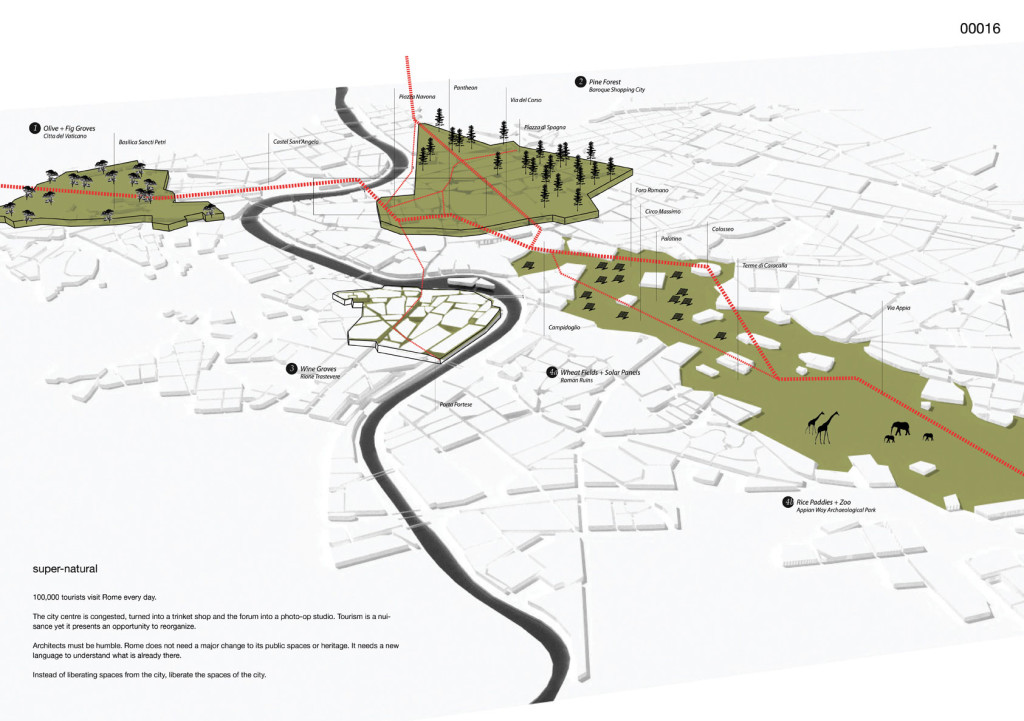
The Rome old town is the largest old town in the world; it is surrounded by the “aureliane” walls, so-called from the emperor Aureliano who built them in 270 A.D., with a 19 kilometers initial full-length and used to defend the city from several barbaric invasions. These walls are regarded as a real boundary between center and suburbs, nowadays with their 12 kilometers length.
Our old town is a place of cultural heritage, it’s rich of beautiful sites and archeological digs with ancient and modern artistic presences, usable indoor and even more outdoors thanks to walks and tours possible to enjoy all over the year.
The historical heritage needs special care and an obliged protection, because it’s precious for each living and future generation. The need of protecting and constantly and attentively maintaining it contrasts with an indiscriminate presence of traffic and present pollution.
We believe that Rome has its own historical structure to preserve, live and especially use with interventions that can make easier the connection with the rest of outlying areas, which appears to be, to this day, seriously compromised in its relation with the old town.
We thought over a futurist vision and an innovative studying to bring back these two realities (city centre and peripheries) to live a relationship of mutual membership, that can help life and erase the image of a divided capital city.
We strongly believe that Rome has to acquire a futurist vision and adequately revolutionary, that connects again not only its own old town with peripheral reality, more and more isolated and distant, but also feeds and facilitates the relation and the life between these “two cities”.
From this idea arises the concept of ISLAND.
It’s well know that there is an island in the city: it’s the Tiberina (the name comes from the river Tevere) Island, which in the river flow divides and at the same time unites the two banks.
An island conceived as a landing place, as a passageway, as a resource, as a meeting-point, as a means that takes part in and invites the relations among the parts.
An island which lives thanks to everybody’s involvement and replies to the modern challenges such as the sustainability, technological innovations and the environmental protection, without precluding to the old town the pedestrians’ only presence. The green area – conceived as a common good shared and beneficial for all – is guaranteed by the creation of a park (PARKBUS), where the eco-friendly means of transport pass giving the pleasure of a direct contact with the environment in the island. Private and public means of transport. Sporty trails thanks to Tevere banks’ revaluation. In the island there will be accommodations and all the services useful to citizens and tourists, with information-points as well as exhibition sites and sights of common interest.
The island lives continuously, thanks also to parking areas which answer to the needs of people who want or have to go in the old town, that won’t be unconditionally pedestrian but also available to bicycles and practicable for eco-friendly transports, which go across or depart from the island. The island will give to the user the solution and the encouragement to live the city without feeling hindered in his interests.
The islands will be set in six crucial point of the city, along the “aureliane” walls, creating a real coupling of reciprocal road network from outside to inside the old town. These structures will be situated in the most interesting – from the point of view of stationing and confluence – city areas, such as: Piazzale Flaminio, Porta Pia, Porta Maggiore, Cristoforo Colombo, Piramide and Aurelia.
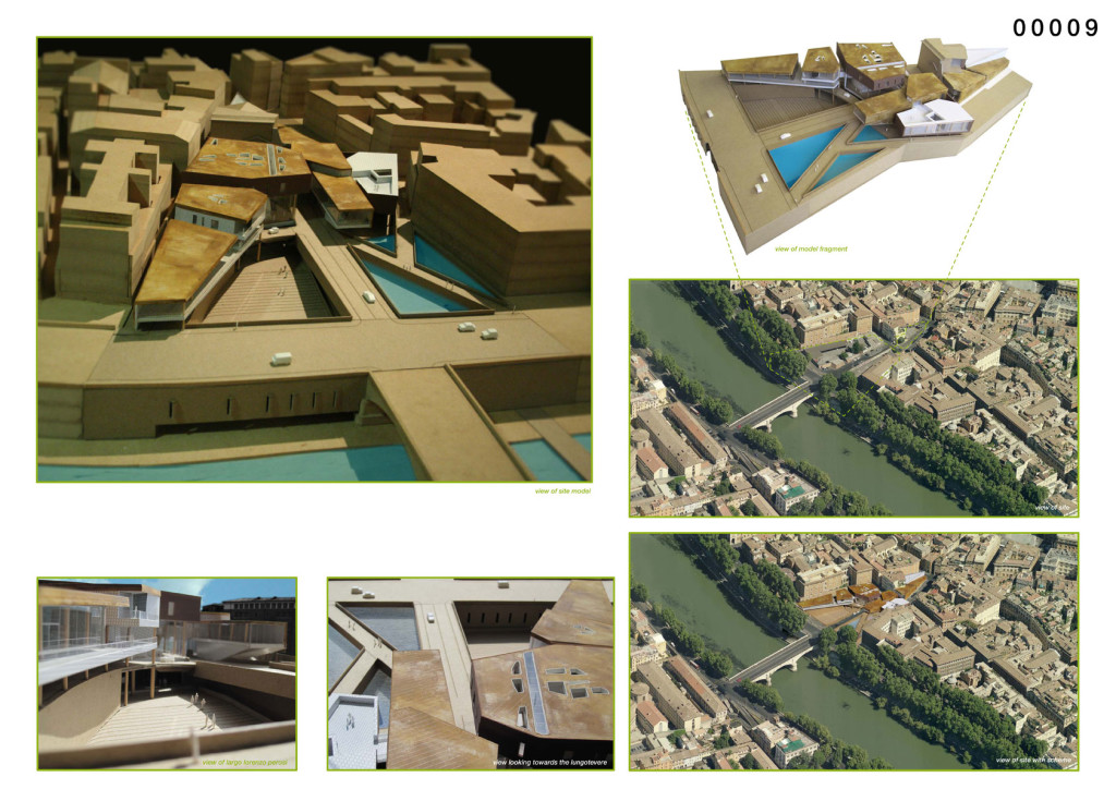
Our project analyzes in particular the area of Porta S.Paolo Piramide, Ostiense district, where currently there are public transports on preferential lane and rails, the underground station, several buses terminus and the railway station.
The island is a body composed by two clearly identified structures. The first one will be structured for underground parking entry (composed by three levels for a total number of 2600 car-parks). The roof area will be covered with a green-roof. The second one will have a 650 square meters photovoltaic coating, that will supply 325.162,5 Kwh per year of energy available to use for all recharge needs of electric public transport battery life. Moreover the rainwater will be collected for irrigation of green areas present in the island (PARKBUS).
In these structures there will be: bicycle parking, car parking, shopping center, lifts of parking levels, info points for cultural and sports trails studied and analyzed by our team.
The cultural trail schedules for example the arrival from the island to the closest monument, and then to the entire route (visible in the 1st table in red color). At the same time we thought about sport trails, which can be of different athletic disciplines, such as biking, going canoeing, horse riding; these trails could start from the islands and finish at the “Isola Tiberina”, that will become a real true road network.
The PARKBUS will be present in every island and will include a rest stop, a recreation area for children, an exhibition area and an outdoor theatre used for social events, social gatherings, in addition to buses platforms, equipped with photovoltaic roofs useful to light up the PARKBUS.


