
Latent Skyline
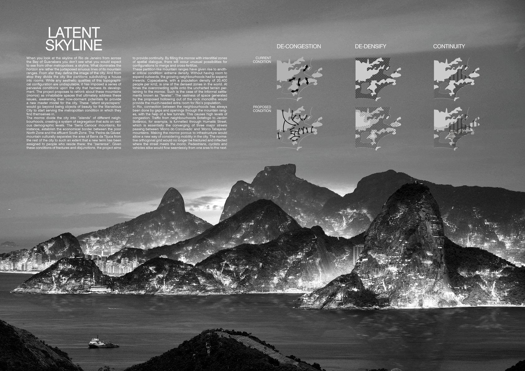
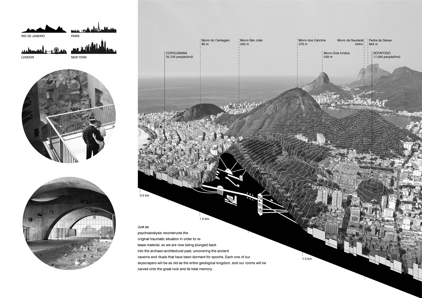
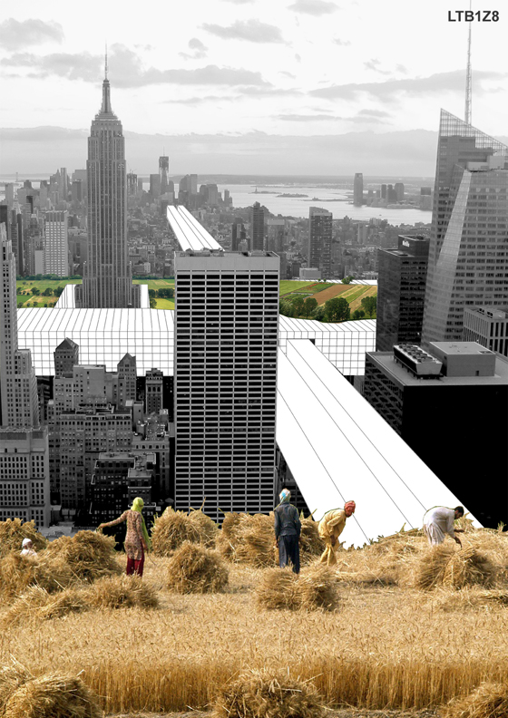
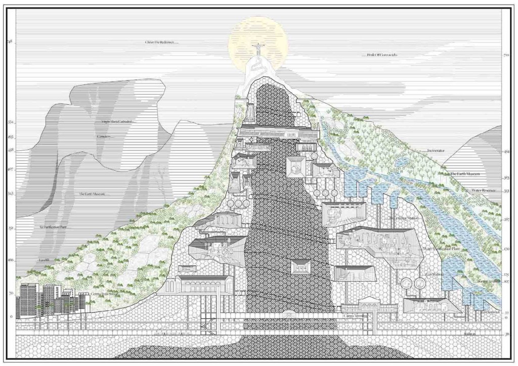
When you look at the skyline of Rio de Janeiro from across the Bay of Guanabara you don’t see what you would expect to see from other metropolises: a skyline. What dominates the horizon are rather the juxtaposed sinuous lines of its mountain ranges. From afar they define the image of the city. And from atop they divide the city like partitions subdividing a house into rooms. While any aesthetic qualities of this topographical configuration are undisputable, it has imposed a series of pervasive conditions upon the city that harness its development. The project proposes to rethink about these mountains (morros) as inhabitable spaces that ultimately address these issues, awakening their now-dormant potentials to provide a new master model for the city. These “latent skyscrapers” would go beyond being objects of beauty for the Marvellous City to start serving the metropolitan condition in which they find themselves in. The ‘morros’ divide the city into “islands” of different neighbourhoods, creating a system of segregation that acts on various demographic levels. The ‘Serra Carioca’ mountains, for instance, establish the economical border between the poor North Zone and the affluent South Zone. The ‘Pedra da Gávea’ mountain culturally separates the area of Barra da Tijuca from the rest of the city to such an extent that a new term has been assigned to people who reside there: the “barrense”. Given these conditions of fractures and disjunctions, the project aims to provide continuity. By filling the ‘morros’ with interstitial zones of spatial dialogue, there will occur unusual possibilities for configurations to merge and cross-fertilize. These partition-like mountain ranges have given rise to another critical condition: extreme density. Without having room to expand outwards, the growing neighbourhoods had to expand inwards. Copacabana, with a population density of 20,400 people per km2, is one of the densest zones in the world. At times the overcrowding spills onto the uncharted terrain pertaining to the ‘morros’. Such is the case of the informal settlements known as “favelas”. The vastness of space generated by the proposed hollowing out of the rock monoliths would provide the much-needed extra room for Rio’s population. In Rio, connection between the neighbourhoods has always been done by gaps and openings through the mountain ranges, with the help of a few tunnels. This causes high levels of congestion. Traffic from neighbourhoods Botafogo to Jardim Botânico is funnelled through Humaitá Street, which is essentially the converging of three major streets passing between ‘Morro do Corcovado’ and ‘Morro Tabajaras’ mountains. Making the ‘morros’ porous to infrastructure would allow a new way of considering mobility in the city. The normative orthogonal grid would no longer be fractured and inflected where the street meets the ‘morro’. One would flow seamlessly from one area to the next.


Info:
Title: Latent Skyline
Time: 4 agosto 2013
Category: Rio de Janeiro
Views: 6301 Likes: 5
Tags: -